Your Source for Outdoor Adventure
Northern California and Southern Oregon
Oops! There was a problem loading this requested page.
We are working to fix the problem, until then, please enjoy the latest articles from MyOutdoorBuddy.
We are working to fix the problem, until then, please enjoy the latest articles from MyOutdoorBuddy.
Latest Articles

Spring Time Water Releases and Fall Salmon Quotas
Trinity River Fishing
by E.B. Duggan, APRIL 15, 2024
Trinity River - Willow Creek Weir
Trinity River Fishing
by E.B. Duggan, APRIL 15, 2024
Trinity River - Willow Creek Weir
Well it is that time of year when water releases will begin to increase for the spring releases. Releases will begin Tuesday April 16 through Sunday August 4, with three pulses and a high flow of 8,500cfs on April 23. Again. we will have high water during the summer months so please be aware of this and be extra careful...
Full Story
Full Story
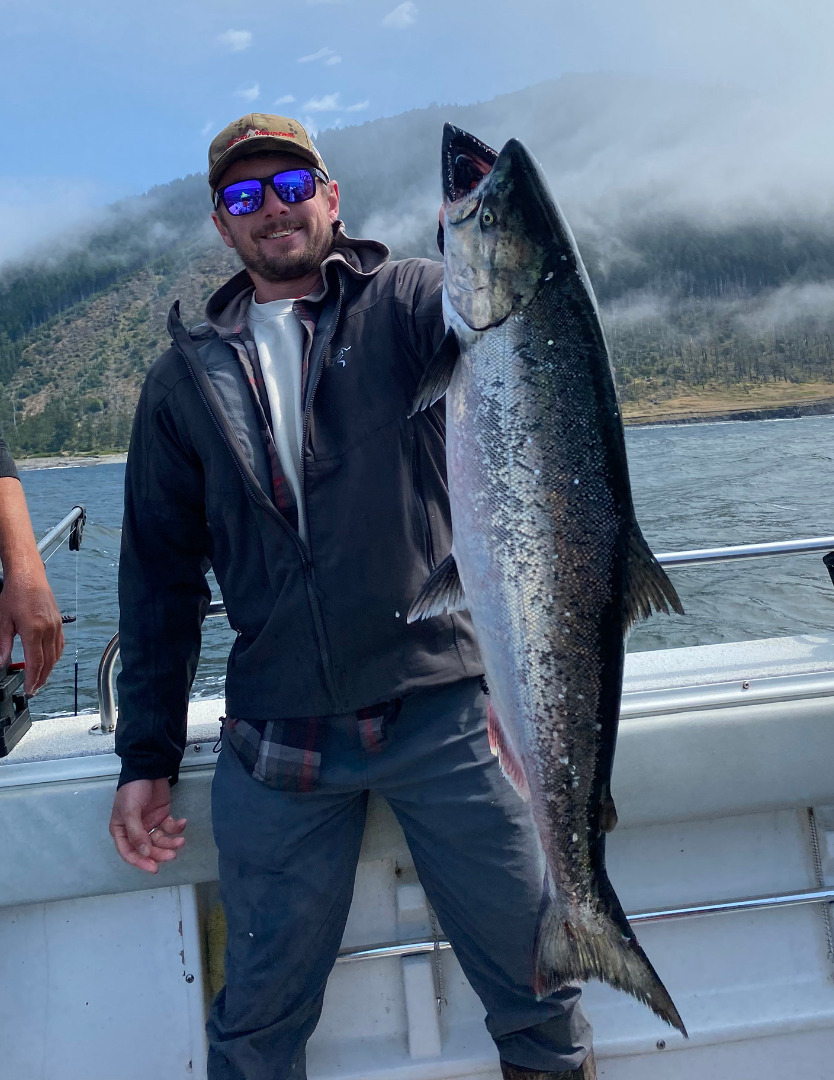
The Pacific Fishery Management Council officially pulled the plug on California’s ocean salmon season April 10. Pictured is Calvin Wagner of Boulder City, Nevada who landed a nice king while fishing out of Shelter Cove back in 2022. Photo courtesy of Jake Mitchell/Sea Hawk Sport Fishing
At the March Pacific Fishery Management Council (PFMC) meeting, the Council voted on and approved...
Full Story
Full Story
Estimated PFMC Fish Returns For Klamath River Basin
Trinity River Fishing
by E.B. Duggan, APRIL 9, 2024
Trinity River - Willow Creek Weir
Trinity River Fishing
by E.B. Duggan, APRIL 9, 2024
Trinity River - Willow Creek Weir
I hope everyone had a Happy Easter, I had the flu and that is why there was not Fish Report. Sorry!
The Klamath River Basin Fall Chinook Salmon returns were a little better that estimated but were far from restoring the Salmon runs and the fishery. There needs to be a total review of the restoration program to try and improve...
Full Story
Full Story

When: April 20 and April 21, 2024
Fishing Hours: 5am to 4pm, weigh in from 2:30pm to 4pm. Raffle and prizes to follow weigh in.
Weigh In Time: 2:30pm to 4pm
Where: Colusa State Park, Weigh In Colusa Public Ramp
Address: 50 Tenth St. Colusa, 95932
What: On the Sacramento River
Rules: https://ncgasa.org/.../03/2024-Striped-Bass-Derby-Rules.pdf
Sign up on ncgasa.org
...
Full Story
Full Story
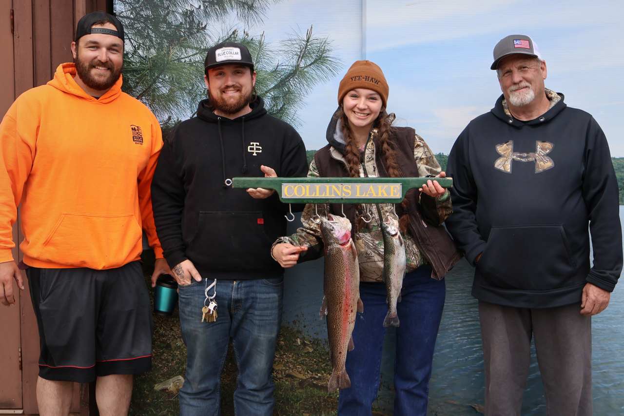
Collins Lake is now 100% full, spilled for a few days earlier this month, has risen again, and is currently spilling a second time. Bass have been active with lots of anglers doing catch & release mostly using lures along the surface. As it starts to warm up in April consider trying roboworms, live crawdads or minnows as the bass...
Full Story
Full Story

River Health Continued
Trinity River Fishing
by E.B. Duggan, MARCH 25, 2024
Trinity River - Willow Creek Weir
Trinity River Fishing
by E.B. Duggan, MARCH 25, 2024
Trinity River - Willow Creek Weir
Last week I touched on the health of the North Coast Rivers. I would like to continue on this subject for this week. To begin with I received, by email, a study on Algae, its benefits and how it helps newly hatched salmonoids. The problem is there was nothing about the health affects to animals or humans. As many of...
Full Story
Full Story
Page 1 Next>
MyOutdoorBuddy.com © 2024. All Rights Reserved.
Website Hosting and Design provided by TECK.net
Website Hosting and Design provided by TECK.net